Real Time Disaster Assessment Solutions
AIgorithm platform has set up a satellite data pipeline providing near real-time (some areas 4-hourly) analytics on floods, fires, frost, hail, heat, drought, and other natural disaster impacts to property. We then assess if buildings are within impact zones, hectares impacted, type of land use, and severity.
Flood
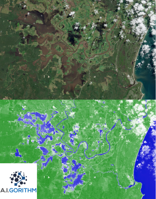
We detect surface water at 10-meter resolution using multiple satellites — some working even with cloud cover. A big four bank requested a list of impacted properties during the North Queensland floods — AIgorithm delivered the report within a day.
See a demo here →Fire
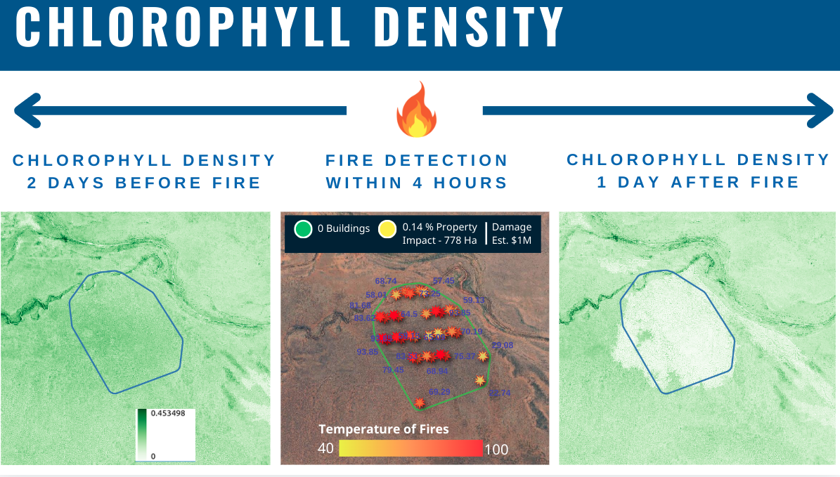
We utilize a few approaches to detect fire — from surface temperature to specific light bands emitted by fire. We measure vegetation health and generate polygons of the impacted area, calculating buildings affected, land use, and burn severity.
Frost
When a frost event occurs, we measure changes in vegetation health before and after. This helps quantify the severity and spatial extent — which can vary dramatically depending on paddock conditions, crop type, and growth stage.
Abnormal Growth
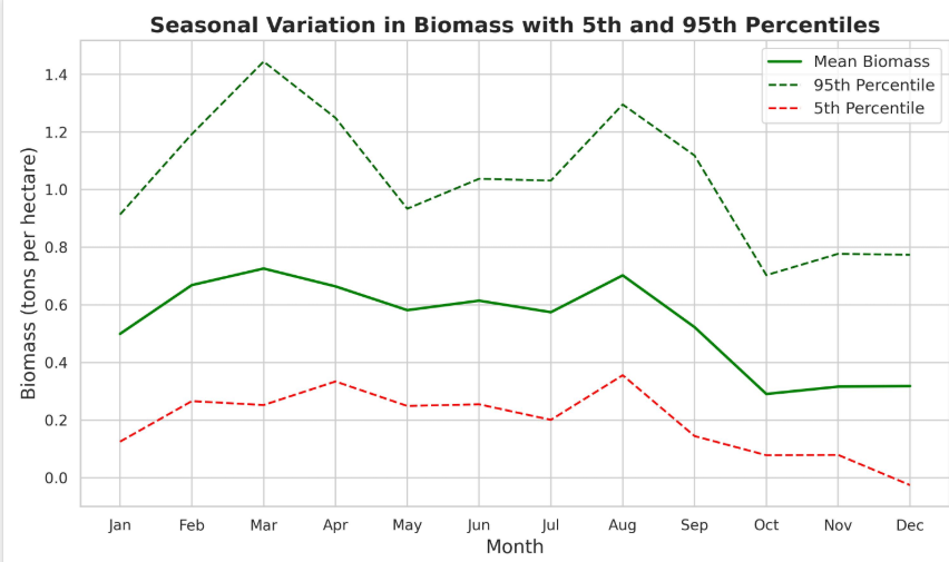
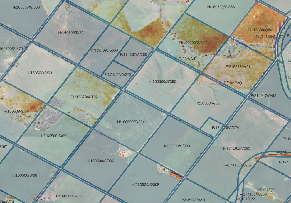
We track crop growth percentiles against historical records to identify underperforming areas. This helps highlight stress early, before it becomes visible — supporting early intervention, benchmarking, and financial risk modelling.
Drought
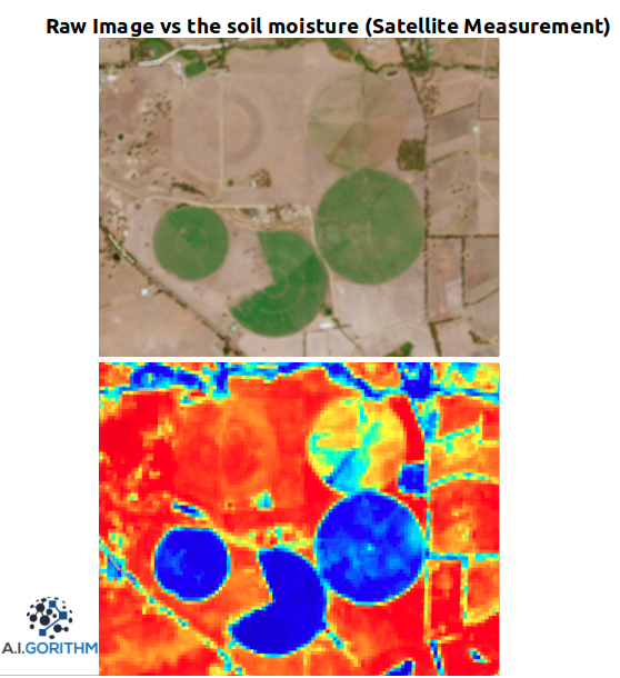
We monitor root zone soil moisture and rainfall trends to assess drought in real time. Our system maps both current stress and cumulative rainfall deficits — allowing drought identification at regional or paddock scale.
Forecast Risk
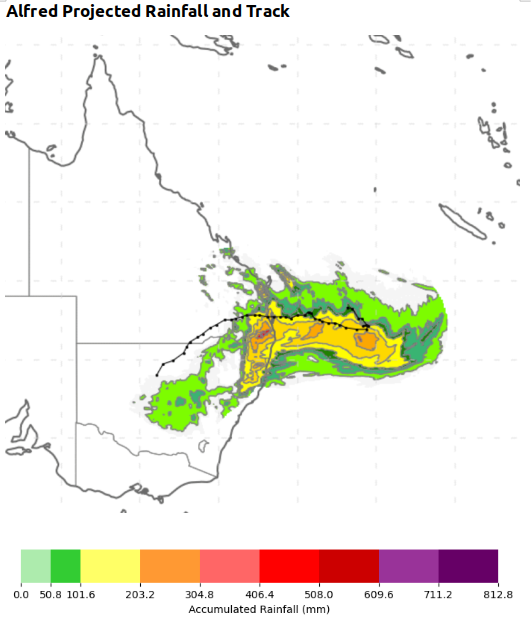
Using global weather models, we forecast upcoming risk to vegetation and assets. We provide advanced warnings of heatwaves, frost, fire risk, and soil moisture anomalies — helping clients act before damage occurs. We also overlay the forcast weather to stress test senarios.