Property Profile & Q&A
Summary of the farm critical information, and ability to ask questions suitability to crops, risks of soil types etc.
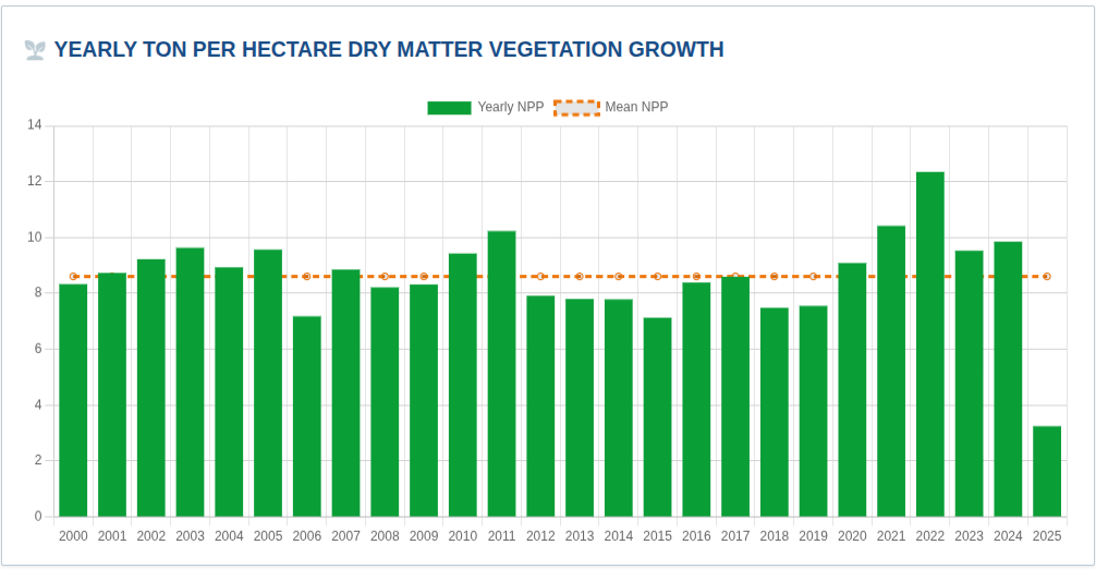
40+ years of satellite history on vegetation growth, rainfall and soil moisture, with hazard context (fire, flood, drought, frost) — distilled into a fast, decision-ready report for farm buyers.
Summary of the farm critical information, and ability to ask questions suitability to crops, risks of soil types etc.
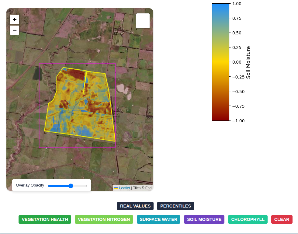
Understanding the farm within paddock, soil moisture, nitrogen, biomass, yeild, surface water
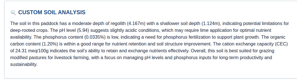
plain-English interpretation for management to understand soil compistion, fertility, ph, depth of soil risks and benefits.
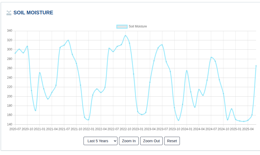
Interactive monthly series with quick filters for last 1–10 years and zoom controls.
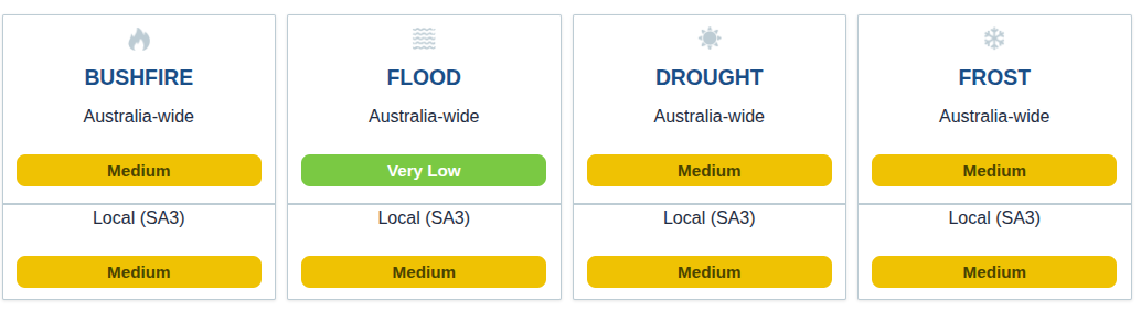
Australia-wide and local (SA3) scores for bushfire, flood, drought and frost — at a glance.
Explore an interactive demo: pan/zoom the map, toggle vegetation and moisture overlays, and review charts for growth, rainfall and soil moisture history. Click “Open full demo” for the best experience.
“I can much easier see all the risks, and it helps me find a good farm.” — Bruce, VIC farmer
Buy a due diligence report in minutes — or open the demo to explore first.