Valuations & Property Risk Information
Gain deep insights into property valuations and inherent risks — without stepping on-site. Our platform uses spatial intelligence, historical productivity, infrastructure mapping, and environmental hazard layers to deliver high-confidence, desktop-based property profiles for insurers, lenders, and agribusinesses.
🔎 Seamless Search & Parcel Insights
Find any rural property in seconds. Simply enter an address, and our platform auto-detects matching land parcels, overlays risk layers, and provides instant access to valuation, production, and climate exposure reports.
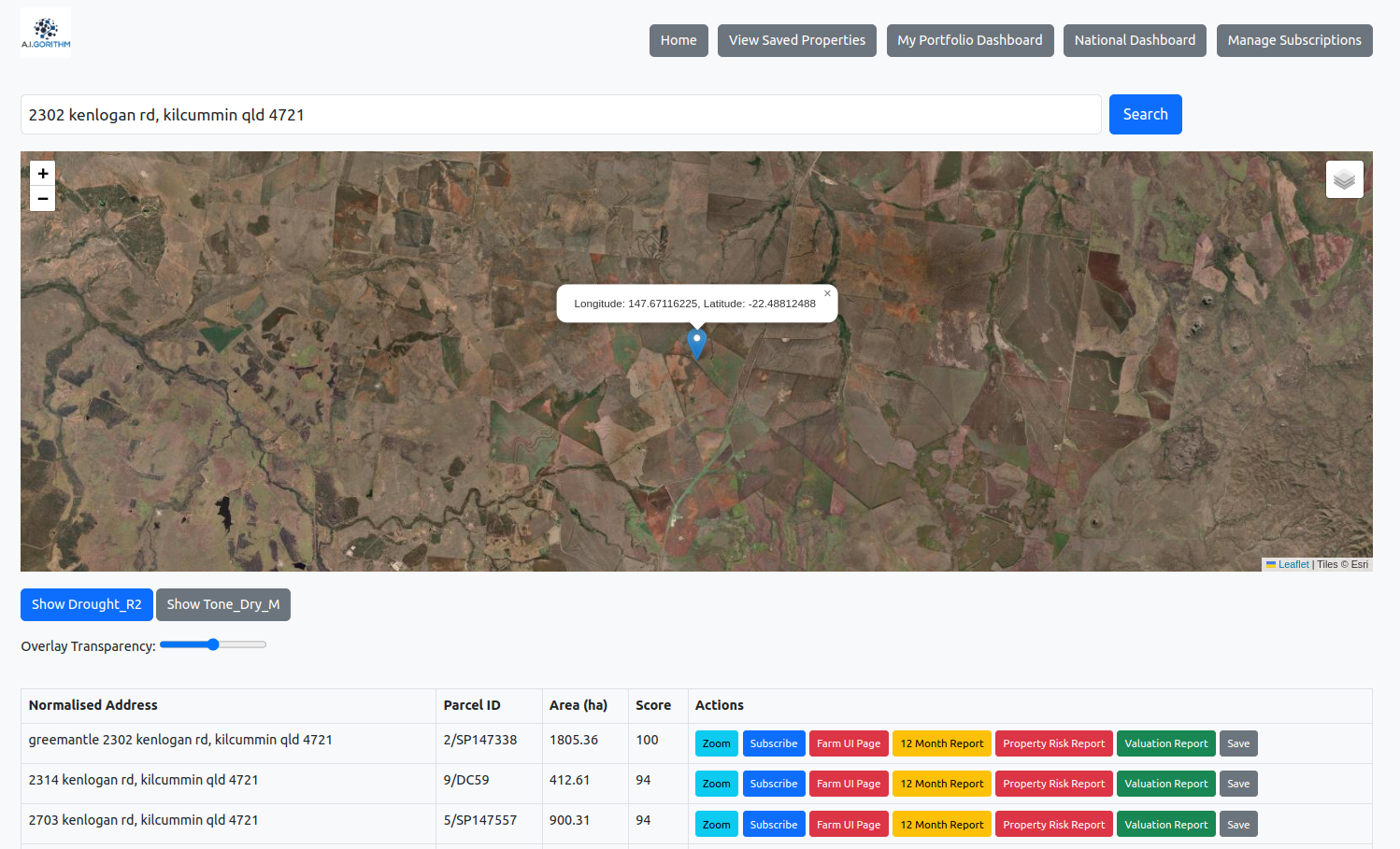
- Instant parcel lookup via address or coordinates
- Overlay drought, fire, or vegetation metrics with one click
- Compare scores and hectares across multiple parcels
- Generate and export property reports in seconds
📍 Desktop Valuation Model
We calculate estimated valuations based on building footprint, land use, pasture/cropping productivity, and localized market indices. This allows underwriters and assessors to understand the value of improvements and potential production remotely.
- Building size × cost/m² estimation
- Inferred livestock headcount from land use & size
- Annual cropping revenue potential
- Replacement value estimate for infrastructure
- Comparable productivity-based valuation proxy
🔥 Risk-Weighted Insights
We overlay natural hazard layers and benchmark risk scores by percentile, enabling portfolio-level stress testing and claims scenario analysis.
- Fire, flood, and frost exposure scores
- Past event footprint overlays
- Benchmark farm to region in terms of yeild and variances in years
- Historical resilience and NDVI recovery rates
- Sum insured vs risk-adjusted value gap
🔄 Change Detection & Monitoring
Track land use and productivity change over time — such as vegetation clearing, infrastructure development, irrigation expansion, and biomass shifts.
- 5- and 10-year change in vegitation growth rates, or building area change
- Detection of new sheds, pivots, or re-vegetation
- Land use classification shifts by paddock
- Grazing/cropping potential and stocking estimate changes
📊 Delivery Formats & Use Cases
Our valuations and risk data help insurers assess replacement costs, underinsurance, and payout limits. For banks, it supports credit risk review, climate exposure scoring, and regional market insights.
- Interactive dashboard with map, charts, and trends
- API integration for underwriting & lending platforms
- Custom-branded PDF reports for portfolios or single properties
- Bulk portfolio uploads & valuation summary exports