Understanding Risk
“History doesn’t repeat itself, but it often rhymes.” — Mark Twain
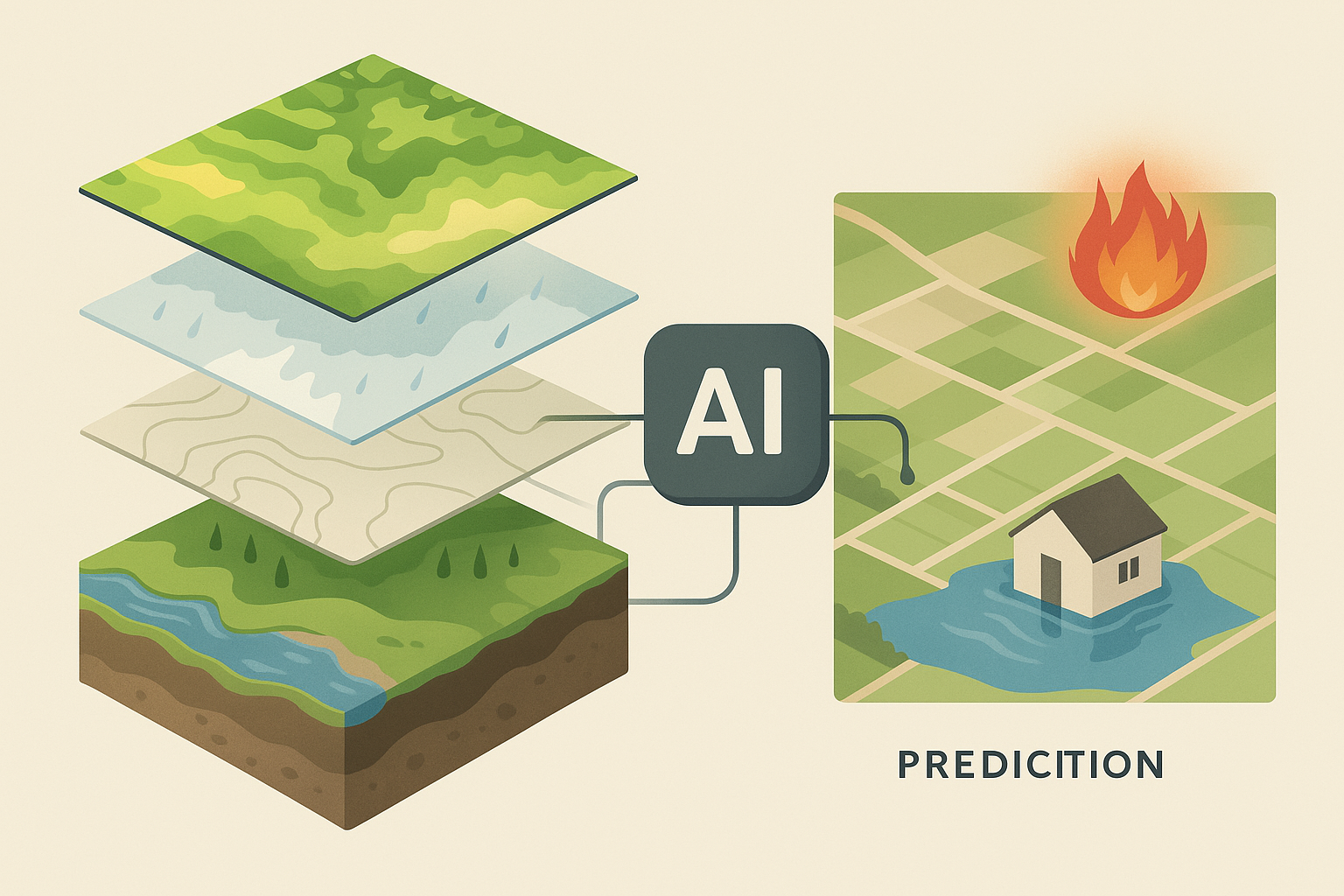
Our Risk Modelling Approach
To deliver the most accurate and actionable insights, we layer decades of historical data with machine learning and climate forecasting — providing predictive risk at the property level.
🪸 Build the Foundation: Historical Intelligence
The strongest predictions are built on deep history. We ingest many terabytes of data over 40+ years — including soil moisture, vegetation indices, rainfall, biomass, and disaster event data across Australia from NASA, Sentinel, BOM, ABARES, and more. Many of these areas have both better history as a person cannot perfectly remember decades, they also have better measurement capability, areas like soil moisture is within 4% of actual.
🧠 Train AI on What Actually Happened
Our AI models are trained on known historical events — learning patterns in spatial distribution, lead indicators, and severity. We don’t just monitor — we teach machines to recognise and anticipate risk, drawing lessons from thousands of past events.
📈 Predict & Stress Test Property-Level Risk
We combine real-time satellite and weather data with global models like GFS and ECMWF to forecast disaster risk. Our system benchmarks each property’s risk percentile, simulates future climate scenarios, and helps decision-makers proactively manage exposure.